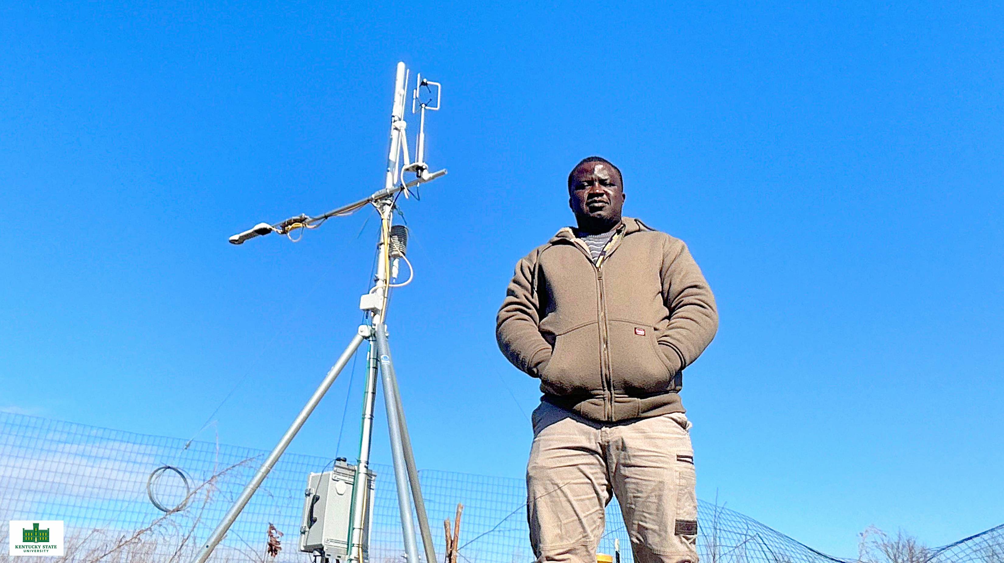
Developed by Kentucky State University research associate Ife Familusi, FluxDash helps students and scientists understand how forests, farms, and other landscapes interact with the atmosphere
FRANKFORT, Ky. — Specialized research towers using mounted sensors are able to continuously measure things like carbon dioxide, water vapor, heat, and air movement. These towers use a research method known as eddy covariance, which tracks what moves between the land and the air above it.
The information they collect can help scientists answer important environmental questions: Is the land storing carbon or releasing it? How much water are plants using? How does a landscape respond to drought, changing weather, or human activity? How well are former mine lands recovering?
But while the towers produce an enormous amount of data, turning those numbers into useful findings can require advanced training and several different computer programs.
Kentucky State University Research Associate Ife Familusi developed his own program called FluxDash to make that work easier to learn and perform. The desktop software guides users through reviewing environmental measurements, finding possible problems, filling gaps in the data, and creating charts and summaries that are easier to understand.
“Environmental data analysis can be intimidating for students and early-career researchers because it often requires several software environments, technical decisions, and processing steps,” Familusi said. “FluxDash was created to bring those steps into one learning-focused platform so users can see what goes into the analysis without being overwhelmed by the entire technical depth at once.”
With Familusi’s program, users can turn raw readings into daily, monthly, and annual summaries. They can estimate how much water moves from soil and plants into the atmosphere, determine whether a landscape stores or releases carbon, and create tables and graphics for reports and presentations.
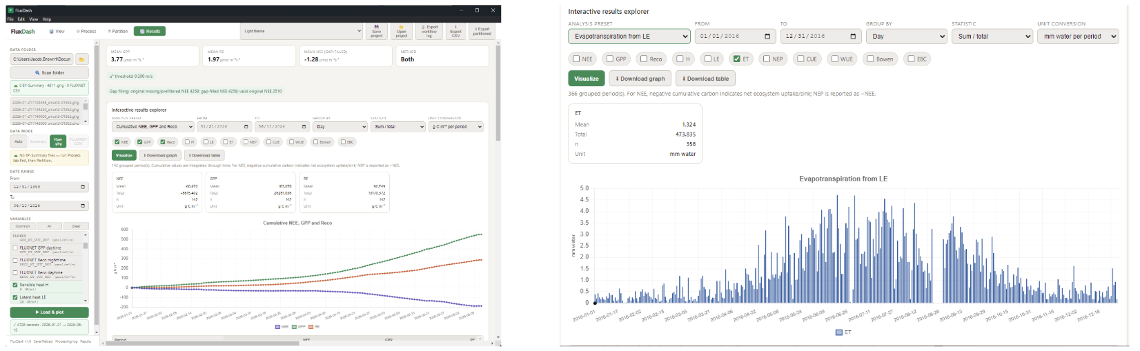
A built-in record also documents the choices users make as they analyze the information. That feature helps students and researchers explain how they reached their conclusions and allows others to review or repeat their work.
“FluxDash transforms a complicated research process into a more approachable teaching and analysis tool,” said Dr. Buddhi Gyawali, professor of geospatial applications, human dimensions, and climate studies. “Students can begin working with important environmental information while also learning the scientific decisions behind the results.”
Familusi earned his Master of Science in Environmental Science and Technology from Kentucky State in December 2024. His graduate research drew upon 12 combined years of observations from a Central Kentucky pasture and a deciduous forest to examine how the two landscapes exchange carbon dioxide with the atmosphere. That work contributed to studies published in the scientific journals Atmosphere and Forests.
Since completing his degree, Familusi has continued working with the University’s Soil Health Laboratory and Center for Geospatial Intelligence and Environmental Security. He also oversees the flux tower supporting Kentucky State’s land-reclamation research work in Eastern Kentucky.
At the Martin County site, researchers examine how vegetation returns to former mine lands, how water moves through the landscape, and how well those areas recover over time. The work also provides students and early-career professionals with practical experience collecting and interpreting environmental information.
“FluxDash has strong potential as both a teaching aid and a practical research tool,” said Dr. Maheteme Gebremedhin, chair of the School of Agriculture and Natural Resources and associate professor of soil science. “It helps students understand how measurements collected in the field become meaningful information about the health and performance of an ecosystem.”
The software is expected to support training in ecosystem monitoring, climate resilience, geospatial environmental science, and carbon-cycle research at Kentucky State and among collaborating research partners.
Part of the data used to develop and test FluxDash came from the eddy flux installation in Martin County, Kentucky. The installation received support through two U.S. Department of Agriculture Evans-Allen grants: “Ecological Resilience and Extreme Weather Events: Impacts on Small Farmers, Landowners, Rural & Urban Communities” (accession No. 7003276) and “Studying Long-term Agroecosystems Changes in Reclaimed Mine Land Properties in Eastern Kentucky” (accession No. 7005721).
The U.S. Department of Energy’s “Geospatial-Artificial Intelligence Enhanced Curriculum for Minority Serving Institutions” grant (award No. DE-EM0005308) also supported the work. Dr. Gyawali directs all three projects.
The program and its supporting materials are available through the project’s GitHub repository.